How Do I Get Google Maps to Connect to My Car Step by Step
Learning how do I get Google Maps to connect to my car is easier than you think. This guide walks you through Android Auto, Apple CarPlay, and Bluetooth setup steps for seamless GPS navigation. Whether you drive a new sedan or an older model, you will find a method that works for you.
Have you ever jumped in your car and wished you could just pull up Google Maps without fumbling with cables and settings? You are not alone. Millions of drivers want to know how do I get Google Maps to connect to my car and start navigating with ease.
The good news is that connecting Google Maps to your vehicle is straightforward. Whether you have a brand-new infotainment system or an older car with basic Bluetooth, there is a way to make it work. This guide breaks down every method step by step so you can get going quickly.
We will cover Android Auto, Apple CarPlay, Bluetooth pairing, and wireless connections. You will also learn tips to keep your navigation smooth and reliable. Let us dive in and get your maps working in your car.
Key Takeaways
- Android Auto and Apple CarPlay are the two main ways to get Google Maps running in your car.
- Wireless and USB connections both work, but wireless offers more convenience once set up.
- Bluetooth pairing is the fallback method for cars without smart infotainment systems.
- Voice commands keep your eyes on the road and hands on the wheel while navigating.
- Regular app and map updates ensure you get accurate directions and real-time traffic data.
- Not all cars support all methods, so checking your car’s compatibility first saves time.
- Setting up Google Maps before you drive prevents distractions and keeps you safe on the road.
📑 Table of Contents
- Why Connecting Google Maps to Your Car Matters
- How Do I Get Google Maps to Connect to My Car Using Android Auto
- How Do I Get Google Maps to Connect to My Car Using Apple CarPlay
- Connecting Google Maps Through Bluetooth for Older Cars
- Troubleshooting Common Connection Issues
- Tips to Get the Best Google Maps Experience in Your Car
- Comparing Connection Methods: Which Is Right for You?
- Expert Insights on Car Navigation Setup
- Key Takeaways
Why Connecting Google Maps to Your Car Matters
Google Maps has become one of the most popular navigation tools in the world. It gives you real-time traffic updates, alternative routes, and voice-guided directions. When you use it on your phone alone, holding the device while driving is dangerous and often illegal.
Connecting Google Maps to your car screen solves this problem. You get a larger display, hands-free control, and safer driving. The hands-free driving experience keeps your focus where it belongs: on the road ahead.
Here are a few reasons why car-connected GPS navigation makes a big difference:
- Larger screen display makes directions easier to read at a glance.
- Voice-guided navigation lets you keep your eyes on the road.
- Real-time traffic updates help you avoid delays and find faster routes.
- Hands-free control means you can search for destinations without touching your phone.
- Seamless smartphone integration keeps your phone charged and connected.
Once you understand the benefits, the setup process becomes much more appealing. Let us look at the different ways you can connect Google Maps to your car.
How Do I Get Google Maps to Connect to My Car Using Android Auto
If you drive an Android phone, Android Auto is the best way to bring Google Maps into your car. It mirrors your phone screen onto your car’s infotainment display. You get all the features of Google Maps with a car-friendly interface.
What You Need Before Starting
Before you begin, make sure you have the right setup. Here is a quick checklist:
- An Android phone running version 6.0 or newer.
- The latest version of Google Maps installed from the Play Store.
- The Android Auto app downloaded on your phone.
- A compatible car or aftermarket head unit that supports Android Auto.
- A USB cable (for wired connection) or a compatible wireless setup.
Not sure if your car supports Android Auto? Check your car manufacturer’s website or your infotainment system’s settings menu. Most cars made after 2016 offer some level of support.
Step-by-Step Setup for Wired Android Auto
Follow these steps to connect Google Maps using a USB cable:
- Plug your phone into the car’s USB port. Use the cable that came with your phone for the best connection.
- Unlock your phone. Android Auto may ask you to confirm the connection on your screen.
- Open Android Auto on your car screen. The app should launch automatically or appear in your infotainment menu.
- Select Google Maps as your navigation app. Android Auto lets you choose your default navigation tool.
- Search for a destination. Use the car’s touchscreen or voice commands to enter where you want to go.
- Start navigating. Google Maps will display directions on the big screen with voice guidance.
Setting Up Wireless Android Auto
Wireless Android Auto removes the need for cables. It connects your phone to your car over Wi-Fi. Here is how to set it up:
- Check if your car supports wireless Android Auto. Not all cars have this feature. Newer models from brands like Sony, Volvo, and Polestar support it.
- Enable wireless Android Auto on your phone. Go to Settings, then Apps, then Android Auto, and turn on wireless pairing.
- Open Android Auto on your car display. It should detect your phone automatically.
- Pair the devices. Follow the on-screen prompts to complete the connection.
- Open Google Maps and start navigating. Everything works just like the wired version.
Wireless connection is more convenient, but a wired connection tends to be more stable. If you experience glitches, try switching to USB.
How Do I Get Google Maps to Connect to My Car Using Apple CarPlay
If you drive an iPhone, Apple CarPlay is your gateway to Google Maps in the car. CarPlay projects your iPhone interface onto your car’s display. Google Maps works beautifully through CarPlay with full voice guidance and touch controls.
What You Need Before Starting
- An iPhone running iOS 12 or newer.
- The latest version of Google Maps from the App Store.
- A car or head unit that supports Apple CarPlay.
- A Lightning or USB-C cable for wired connection (or a wireless CarPlay-enabled car).
Step-by-Step Setup for Wired CarPlay
Here is how to get Google Maps running through Apple CarPlay:
- Connect your iPhone to the car’s USB port. Use an Apple-certified cable for the best results.
- Tap CarPlay on your car display. It may appear automatically or in your media menu.
- Select Google Maps as your navigation app. CarPlay lets you choose which apps to display.
- Allow permissions when prompted. Google Maps needs access to your location and contacts.
- Search for a destination. Use the car screen or Siri voice commands to find where you are going.
- Start your route. Google Maps will provide turn-by-turn directions with voice prompts.
Setting Up Wireless Apple CarPlay
Many newer cars now support wireless CarPlay. Here is how it works:
- Go to your car’s infotainment settings. Look for the CarPlay or smartphone connection option.
- Select wireless pairing mode. Your car will search for available devices.
- Choose your iPhone from the list. Confirm the pairing on both your car screen and your iPhone.
- Open Google Maps. It should appear as a navigation option on your CarPlay home screen.
- Start navigating. Enjoy the larger screen and hands-free voice guidance.
Wireless CarPlay is a game-changer. You never have to plug in your phone again. Just get in the car, and everything connects automatically.
Connecting Google Maps Through Bluetooth for Older Cars
Not every car has Android Auto or Apple CarPlay. If your car is older or has a basic infotainment system, Bluetooth is your best option. While Bluetooth does not mirror your phone screen, it does let you use Google Maps with audio directions through your car speakers.
Step-by-Step Bluetooth Setup
- Turn on Bluetooth on your phone. Go to Settings and enable Bluetooth discovery.
- Go to your car’s Bluetooth settings. This is usually found in the infotainment or settings menu.
- Search for available devices. Your phone should appear in the car’s device list.
- Select your phone and pair. You may need to confirm a pairing code on both devices.
- Open Google Maps on your phone. Set the audio output to your car’s Bluetooth connection.
- Start navigation. Directions will play through your car speakers, and you can see the map on your phone.
This method works well for basic audio directions. You will not get the map on your car screen, but the voice guidance is clear and reliable. It is a great option for cars that do not support smart projection systems.
Using A Car Mount as a Backup
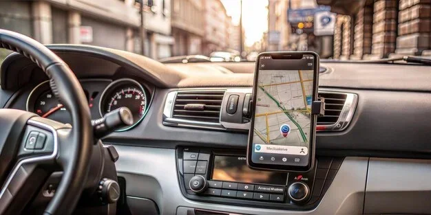
If Bluetooth audio is not enough, consider using a phone mount. You can place your phone on the dashboard or windshield and use Google Maps directly. This gives you a visual display without needing any car integration at all.
Look for a mount that does not block your view. A dashboard phone mount or a windshield suction mount works great. Just remember that you still need to set up navigation before you start driving.
Troubleshooting Common Connection Issues
Sometimes things do not go smoothly. Your Google Maps might not connect, or the connection might drop mid-drive. Here are the most common problems and how to fix them.
Google Maps Will Not Open Through Android Auto or CarPlay
This is a common issue and usually easy to fix. Try these steps:
- Restart your phone. A simple reboot often resolves connection glitches.
- Update Google Maps. Go to the Play Store or App Store and check for the latest version.
- Update Android Auto or CarPlay. Make sure your car’s infotainment software is current.
- Unplug and replug the cable. A loose connection can prevent the app from launching.
- Clear the Google Maps cache. Go to your phone’s Settings, then Apps, then Google Maps, and clear the cache.
Voice Commands Are Not Working
Voice commands are one of the best features of connected navigation. If they stop working, try these fixes:
- Check your microphone settings. Make sure your phone’s mic is not blocked or muted.
- Retrain your voice model. Go to your phone’s voice recognition settings and redo the setup.
- Turn off other Bluetooth devices. Multiple connected devices can interfere with voice input.
- Use the car’s built-in voice button. Many steering wheels have a voice command button that works with Google Maps.
GPS Signal Is Weak or Inaccurate
A weak GPS signal can cause wrong directions or delayed updates. Here is what you can do:
- Move away from tall buildings or tunnels. These block satellite signals.
- Wait for a GPS lock. When you first start the car, give Google Maps 30 seconds to find your location.
- Check your phone’s location settings. Make sure location services are turned on and set to high accuracy.
- Keep your phone cool. Overheating can weaken GPS performance. Do not leave your phone in direct sunlight.
Tips to Get the Best Google Maps Experience in Your Car
Once you have Google Maps connected, you want it to work flawlessly every time. These tips will help you get the most out of your setup.
Keep Your Maps Updated
Google Maps updates frequently. These updates include new roads, changed addresses, and improved routing algorithms. Turn on automatic updates in the Play Store or App Store so you always have the latest map data. Outdated maps can lead to wrong directions and missed turns.
Download Offline Maps for Areas With Poor Signal
Driving through rural areas or tunnels can kill your data connection. Google Maps lets you download maps for offline use. Here is how:
- Open Google Maps on your phone.
- Search for the area you want.
- Tap your profile picture and select Offline Maps.
- Choose Download This Area.
- Adjust the map area and tap Download.
Offline maps work even without internet. You will still get directions and turn-by-turn guidance. Just keep in mind that real-time traffic data will not be available offline.
Use Voice Commands While Driving
One of the biggest advantages of connecting Google Maps to your car is voice control. Instead of tapping on a screen, just say what you need. Try these commands:
- “Hey Google, navigate to [place].” Starts navigation to any saved or searched location.
- “Hey Google, find gas stations nearby.” Shows fuel stations on the map.
- “Hey Google, avoid highways.” Changes your route preferences on the fly.
- “Hey Google, what’s my ETA?” Announces your estimated arrival time.
Voice commands keep your hands on the wheel and your eyes on the road. They make hands-free driving safer and more convenient.
Optimize Your Phone’s Battery and Data
Using Google Maps for long drives drains your battery and uses a lot of data. To avoid problems:
- Plug your phone into a charger while driving. A USB cable connected to the car is ideal.
- Use Wi-Fi when available. Many cars with wireless Android Auto or CarPlay use Wi-Fi, which does not count against your data plan.
- Lower screen brightness. This saves battery and reduces glare on the car screen.
- Close background apps. Free up resources so Google Maps runs smoothly.
Comparing Connection Methods: Which Is Right for You?
Not sure which method to use? Here is a quick comparison of the main ways to connect Google Maps to your car.
| Feature | Android Auto | Apple CarPlay | Bluetooth |
|---|---|---|---|
| Screen mirroring | Yes | Yes | No (audio only) |
| Voice commands | Yes | Yes | Limited |
| Real-time traffic | Yes | Yes | Yes |
| Works on older cars | No (needs compatible head unit) | No (needs compatible head unit) | Yes |
| Wireless option | Yes (select cars) | Yes (select cars) | Yes (built-in) |
| Setup difficulty | Easy | Easy | Very easy |
| Map display on car screen | Yes | Yes | No |
As you can see, Android Auto and Apple CarPlay offer the best experience. Bluetooth is the fallback for older vehicles. Choose the method that matches your car and phone setup.
Expert Insights on Car Navigation Setup
Automotive experts recommend taking a few extra minutes to set up your navigation before every trip. Here is what seasoned drivers suggest:
- Set your destination before you start the engine. Many states and countries have laws against interacting with your phone while driving.
- Use the passenger to help. If someone is riding with you, let them enter the destination or adjust the route.
- Pull over if you need to change something. Safety always comes first. Find a parking spot before making any adjustments.
- Keep a paper map as a backup. Technology can fail. A physical map never runs out of battery.
These small habits make a big difference. They keep you safe and help you get the most out of your connected navigation setup.
Key Takeaways
- Android Auto and Apple CarPlay are the best ways to get Google Maps on your car screen.
- Bluetooth connection works for older cars that lack smart infotainment systems.
- Wireless setup offers convenience, while wired connections tend to be more reliable.
- Voice commands keep you safe by letting you navigate without touching your phone.
- Offline maps save you when you drive through areas with poor data coverage.
- Regular updates to Google Maps and your car’s software prevent connection problems.
- Setting up before you drive is both safer and more convenient than adjusting while on the road.
Frequently Asked Questions
Can I use Google Maps in my car without Android Auto or Apple CarPlay?
Yes, you can. If your car does not support Android Auto or Apple CarPlay, you can still use Google Maps through Bluetooth audio or by mounting your phone on the dashboard. Bluetooth will give you voice directions through your car speakers, while a phone mount lets you see the map on your phone screen.
Is wireless Android Auto better than wired?
Wireless Android Auto is more convenient because you do not need to plug in a cable. However, wired connections tend to be more stable and may charge your phone at the same time. If your car supports wireless, it is a great option. If you experience connection issues, try switching to a USB cable.
Does Google Maps work offline in the car?
Yes, it does. You can download offline maps in the Google Maps app before your trip. Offline maps provide turn-by-turn directions even without an internet connection. However, real-time traffic updates and alternative route suggestions will not be available offline.
Why does Google Maps disconnect from my car while driving?
This usually happens due to a loose USB connection, outdated software, or Bluetooth interference. Try using a different cable, updating both your phone and car software, or restarting both devices. Keeping your phone plugged in with a high-quality cable also helps maintain a stable connection.
Can I use Google Maps on both Apple CarPlay and Android Auto at the same time?
No, you cannot. Google Maps will only display on one system at a time. Android Auto works with Android phones, and Apple CarPlay works with iPhones. Make sure you have selected the correct app on your car’s infotainment system before starting navigation.
How do I get Google Maps to remember my favorite destinations?
Google Maps saves your frequent locations automatically. You can also save specific places by tapping the save icon on any location. When you are in the car, simply say “Hey Google, navigate to home” or “Hey Google, navigate to work,” and it will pull up your saved destination instantly.
=== CONCLUSION ===
Knowing how do I get Google Maps to connect to my car opens up a world of convenience and safety. Whether you use Android Auto, Apple CarPlay, or Bluetooth, the setup process is simpler than most people expect. You can have full GPS navigation on your car screen in just a few minutes.
Start by checking what your car supports. Then follow the step-by-step instructions in this guide. If you run into issues, the troubleshooting section has you covered. Keep your maps updated, use voice commands, and download offline maps for areas with weak signal.
The best part is that once you set it up, you will wonder how you ever drove without it. Google Maps connected to your car makes every trip smoother, safer, and more enjoyable. So grab your phone, follow the steps, and start navigating with confidence today.